Has the Lost City of Bethsaida Finally Been Found?

Articles 2 Comments

The scholarly debate over the location of Bethsaida continues to rage. Now, Mendel Nun, an authority on the Sea of Galilee and its ancient harbors, weighs in on the side of el-Araj.

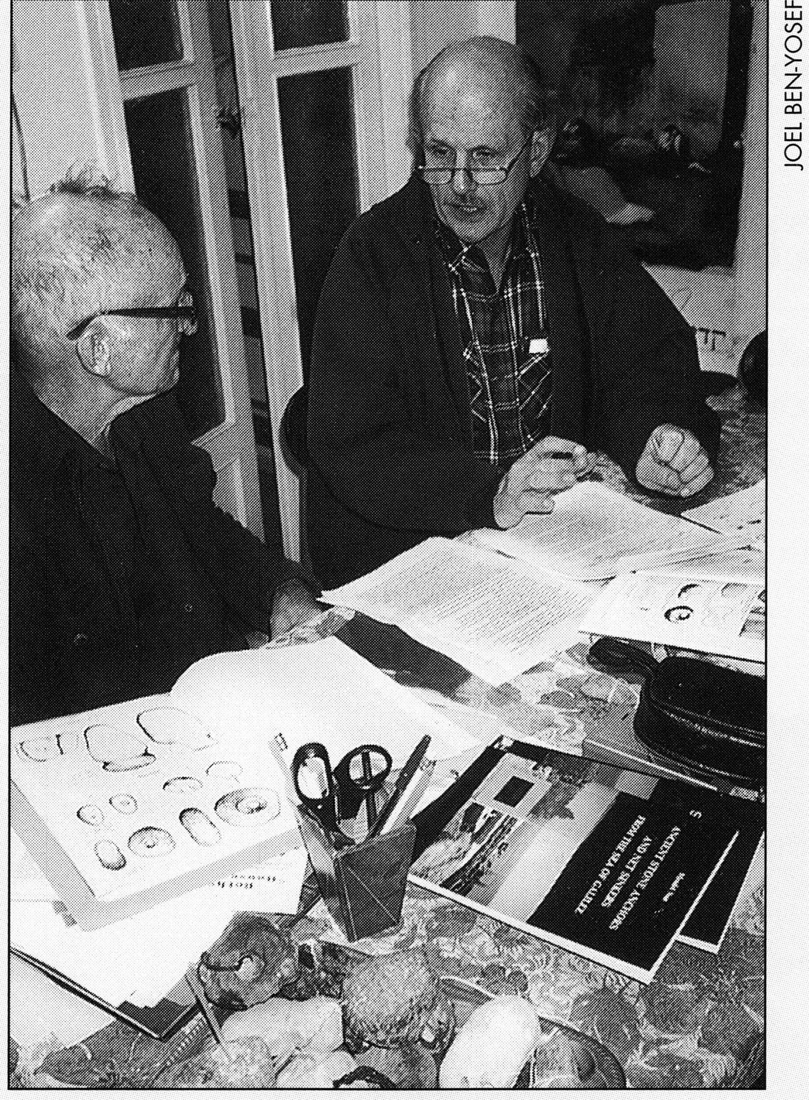
Mendel Nun and JP editor David Bivin working at Nun’s kitchen table. Bivin questions Nun about his “Has Bethsaida Finally Been Found?” as they prepare it for publication. Photographed by Joel Ben-Yosef.


Most people think the search for Bethsaida is over. Archaeological excavations have taken place at et-Tell for ten years, and they continue this summer. Many scholars, too, have accepted Bethsaida Excavations Project director Dr. Rami Arav and his associates’ conclusion that et-Tell is the Bethsaida of the New Testament. So has the Israeli government. Since 1989 Bethsaida has been located at et-Tell on all maps produced by the State of Israel. Even the Vatican has accepted this identification: the Vatican’s committee on holy sites has recognized et-Tell as Bethsaida. Among archaeologists, however, there is growing skepticism about the claims of the et-Tell expedition. Mendel Nun, an authority on the Sea of Galilee and its environs, believes Bethsaida was located at el-Araj, a site on the Sea of Galilee’s northeastern shore near the Jordan River—the lake’s ancient fishing villages were always located on its shores. Nun rejects outright Arav’s contention that he has found the ancient site of Bethsaida. Nun thinks the et-Tell excavation results do not support Arav’s claims, but, in fact, disprove them. Nun calls for a thorough excavation at the el-Araj site, where surface remains are especially impressive.

The fishermen’s village of Bethsaida on the northern shore of the Sea of Galilee is one of the most important holy sites of the Christian world. Yet the question of its exact location in Jesus’ time has long been a troubling and disputed issue.

Some basic clues are provided by the Gospels. According to John, three of Jesus’ apostles—Simon Peter, Andrew and Philip—came from Bethsaida (John 1:44; 12:21). We also know that Jesus performed miracles in Bethsaida: When a blind man was brought to him, Jesus took him to the outskirts of the village and there healed him (Mark 8:22-26). The miracle of the loaves and fish was performed near Bethsaida, when from two fish and five loaves Jesus provided ample food for a multitude of five thousand (Luke 9:10-17).

Bethsaida 003The site of Bethsaida was certainly somewhere on the northeastern shore of the Sea of Galilee, near the inlet of the Jordan River. Opposite Bethsaida, on the northwestern shore about four kilometers across the water was the ancient city of Capernaum. Four kilometers north of Capernaum was the city of Chorazin. Most of Jesus’ Galilean ministry took place in the region of these three cities; hence the term “Evangelical Triangle.” Of the three cities, Capernaum, with its fishing suburb Tabgha, was the very center of Jesus’ activities. From Capernaum he traveled to other towns and villages in Galilee, and from Capernaum’s harbor he sailed to cities on the other side of the lake.

Capernaum is mentioned thirteen times in the Gospels. Jesus stayed there with Simon Peter, who lived with his family in the house of his mother-in-law (Matt. 8:14-15; Mark 1:29-31; Luke 4:38-39). From this we may understand that because of the sons’ marriages, the family had moved from Bethsaida to Capernaum. Thus we see that family and fishing relations connected the two cities of Bethsaida and Capernaum.

Opinions differ as to the length of Jesus’ stay in Capernaum. There are those who believe it was a short time, while others argue that it extended to three years. The sayings and parables of Jesus point to an intimate knowledge of the lake and of the fishing profession, indicating that he stayed in this region for a significant length of time. At Capernaum he healed the sick and performed miracles, and preached in the synagogue on the Sabbath (Matt. 8:16-17; Mark 1:21-28, 32-34; Luke 4:31-37, 40-41). Therefore, Capernaum is known as the “City of Jesus.”

Next to Jerusalem and Capernaum, the city most frequently mentioned in the Gospels is Bethsaida. However, we know nothing of Jesus’ works there, except for the miracle of the healing of a blind man. But his presence in Bethsaida was significant on another level: Herod Antipas, the ruler of Galilee, viewed Jesus with suspicion fearing he would stir political unrest among the Jews in the area, whereas Philip, the more liberal ruler of the neighboring Golan, which had a mixed population, was not troubled by Jesus’ activities.

Jesus’ work in Chorazin is not mentioned in the Gospels. Since most of the Jewish inhabitants of the Evangelical Triangle did not accept his teachings, he reproached them:

Woe to you, Chorazin! Woe to you, Bethsaida! For if the mighty works done in you had been done in Tyre and Sidon, they would have repented long ago in sackcloth and ashes. (Matt. 11:21; Luke 10:13)

From this we may conclude that Jesus performed his “mighty works” in both Chorazin and Bethsaida, even though we are not explicitly told this.

View to the east across the Plain of Bethsaida. On the horizon stands the plateau known today as the Golan Heights. Photographed by Mendel Nun.

The Beteiha: The Bethsaida Plain

The plain to the northeast of the Sea of Galilee, where the various disputed sites for the “lost” city of Bethsaida are located, was for centuries—up until the last generation—called by its Arabic name, Beteiha. This plain was created many thousands of years ago, at the time the lake was formed, by erosion carried by streams flowing down from the Golan. In this, the Beteiha Plain resembles the Gennesaret Plain to the west, although the Beteiha is smaller and richer in sources of water.

Bethsaida 006

The Meshushim Aqueduct at the point where it spans the Yehudiyeh Stream (see map of the Bethsaida Plain below). This is one of the Roman aqueducts that carried water to the Plain of Bethsaida.

The natural borders of the Beteiha Plain are: to the southwest, the shore of the lake (five kilometers) and, to the west, the Jordan River (three kilometers). The slopes of the Golan Heights are the borders to the east and north. The maximum depth of the plain is about three kilometers.

Since Roman times, two large aqueducts were used to water the Beteiha Plain. One brought water from the Jordan River, from four kilometers upstream near ed-Dikkeh. The other took water from the Meshushim Stream to the southern end of the plain. These aqueducts were repaired during later periods in which the plain was cultivated. They were repaired for the last time early in this century, and were in use until 1967, the year the Six Day War brought Arab agriculture in the area to an end.

In the Roman and Byzantine Periods, the plain was densely populated by Jewish villages; their presence has been verified by many ruins. The remains of synagogues discovered in the plain and on the Golan ridge facing the lake point to the prosperity of local Jewish communities during these periods. Arab villages were later built on the foundations of such Jewish settlements. One settlement, a city with the ruins of a synagogue and a stream nearby was known by the Arabs as “Yehudiyeh” (village of the Jews), which indicates that this Jewish settlement existed at least until the Early Arab Period (seventh-eighth centuries C.E.).

The Arabs probably took the name Beteiha from the Jewish residents of the area. The name Beteiha is mentioned for the first time by the tenth-century C.E. Arab geographer et-Tabari, and in a Crusader source of the twelfth century as “Putaha.” It is also mentioned in fourteenth-century Mameluke sources. The name “Beteiha” has a Semitic sound. In Hebrew and Arabic, the consonant root בטח (b-t-h) can mean “to fall” or “to stretch out,”[1] thus “Beteiha” probably refers to the levelness of the plain. For the last twenty years Israelis have called the plain Bik’at Bet Tsaida, the Valley of Bethsaida.

Bethsaida Renamed Julias

In his Antiquities Josephus tells us that Philip, son of Herod the Great, “elevated the village of Bethsaida on Lake Gennesaritis [the Sea of Galilee] to the status of city by adding residents and strengthening the fortifications” (Antiq. 18:28; Loeb edition). According to Josephus, Philip renamed the city Julias after Julia, the daughter of the Roman emperor Augustus. There appears to be an error on Josephus’ part: the newly elevated city was named not after the daughter, but after the wife of Caesar Augustus, the mother of Tiberias.[2] The renaming took place in the year 30 C.E.

This means that while Jesus was active in the area, until about 30 C.E., Bethsaida was still a village. The Gospels do not mention the name Julias at all. Bethsaida appears both as a “village” and as a “city.” Josephus’ identification of Julias with Bethsaida is not made elsewhere in ancient literature.

In the foreground lies the rubble-strewn artificial mound or tell known in Arabic as et-Tell. This tell is identified as Bethsaida by the Bethsaida Excavations Project. On the other (southwest) side of the Beteiha Plain at the Sea of Galilee’s shore (upper right edge of photo) is the clump of eucalyptus trees that marks the el-Araj site.

Philip was particularly fond of Julias-Bethsaida and made it his winter capital. Here he built himself a grand mausoleum in which he was buried when he died in 34 C.E.

The name Julias was not accepted by the Jewish population—in the Talmud “Saydan,” the shortened form of Bethsaida, is used. However, Saydan was also the name of the city of Sidon on the Mediterranean and it is not always easy to know to which city the sources refer. Only two citations in rabbinic literature are unequivocal references to our Bethsaida on the lake. Both are from the second century C.E., and both point to the agricultural and fishing character of the surrounding plain.

According to Midrash Ecclesiastes Rabbah 2:8, Rabbi Yehoshua ben Hanina brought to the Emperor Hadrian “pheasants from Saydan” as one of three proofs that the land of Israel was not lacking in any luxury. (Introduced from Asia, pheasants became a part of the advanced local agriculture.) And in the Jerusalem Talmud, which was written in Tiberias, the Patriarch Shim’on ben Gamaliel recounts how one day in Saydan he was given “a bowl containing three hundred species of fish” (Jerusalem Talmud, Shekalim 50a, chpt. 6, halachah 2).

Bethsaida was a city of Talmudic sages, among them Abba Yudan (Gurion) of Saydan, and Rabbi Yose of Saydan (fourth century C.E.), a fisherman by profession. He was known as Yose Hahorem, that is, Yose the Dragman or Yose the Dragnet Fisherman. The herem, or dragnet, was a type of net much in use for Sea of Galilee fishing, especially fishing along the coast of the Bethsaida Valley.[3]

Julias-Bethsaida is also mentioned in non-Jewish sources. The first-century C.E. Roman historian Pliny the Elder refers to Julias and Hippos as “lovely cities on the eastern side of the lake.” But Pliny is not always reliable. Pliny’s reference to Tarichaea (biblical Magdala) being at the southern end of the lake—actually, it was on the lake’s northwestern shore—is not readily forgiven by geographers.

The second-century C.E. geographer Ptolemy places Bethsaida among the cities of Galilee. (Note that the Evangelist John refers to “Bethsaida in Galilee.”) This is not surprising since in that period the residents of the land considered the eastern shore of the lake as part of Galilee. For the same reason, the Gospels refer to the lake as the “Sea of Galilee.”

The Two Bethsaidas Theory

Bethsaida is mentioned thirteen times in the Gospels and nine times in the writings of Josephus. Despite the relatively large number of references, these sources do not provide conclusive identification of the location of Bethsaida. Sometimes the references are even contradictory. They cannot help us determine where to place Bethsaida on the map.

Luke is the only one of the four Gospels that clearly associates the miracle of the loaves and fish with Bethsaida. According to Luke, Jesus gathers his disciples “and took them and went aside privately into a desert place belonging to the city called Bethsaida” (Luke 9:10). When evening comes, the disciples ask Jesus to “send the multitude away” to the nearby villages to find food and lodging. Instead, however, Jesus multiplies the loaves and fish.

According to Mark, this story has a different, and confusing, sequence. Jesus and his disciples sail to a “deserted place” to rest. When evening comes, the disciples suggest that Jesus send the multitudes who had followed him into the nearby villages to buy food. After performing the famous miracle of the loaves and fish, Jesus tells his disciples to “get into the boat and go before him to the other side, to Bethsaida” (Mark 6:31, 32, 45). The disciples sail off and while at sea they encounter a dangerous storm. Jesus, praying alone on a mountain, sees them in peril rowing desperately against the opposing wind. Jesus walks to them across the water, enters the boat and tells them not to be afraid. The storm subsides and the boat arrives safely. Where? To the land of Gennesaret on the western shore of the lake.

Because of these conflicting accounts, the theory of “two Bethsaidas” was born. Apparently, there was a Bethsaida on the eastern shore, as in Luke, and another on the western shore, as in Mark. This theory has been accepted by many researchers until today.

Josephus describes Bethsaida as “a village on the Sea of Galilee” (Antiq. 18:28). But elsewhere, Josephus states that the Jordan flows into the Sea of Galilee “after passing the city of Julias” (War 3:515), implying that Julias was not right on the shore. Still elsewhere (Life 406), he tells us that reinforcements for the Zealot troops came to Julias from Magdala by boat. The question of the location of Julias has fueled scholarly debate for generations.

El-Araj and et-Tell

The pasha's Arab fishermen working their dragnets along the immaculate el-Araj beach. In the background, next to the eucalyptus trees, can be seen the pasha's two-story residence, Beit ha-Bek. From Rudolf de Haas, Galilee, the Sacred Sea (Jerusalem, 1933), 226.

The pasha’s Arab fishermen working their dragnets along the immaculate el-Araj beach. In the background, next to the eucalyptus trees, can be seen the pasha’s two-story residence, Beit ha-Bek. From Rudolf de Haas, Galilee, the Sacred Sea (Jerusalem, 1933), 226.

The ruins of el-Araj are located on the shore of the Sea of Galilee between the outlet of the Jordan River and the outlet of the Meshushim Stream. In antiquity this shore was one of the lake’s best fishing grounds. During the day, fishermen worked their long dragnets. At night they spread their trammel nets. Their catch was bountiful. The name Bethsaida is a transliteration of the Aramaic bet tsaida (place of the fisherman) and means “fishing village.”

During the last third of this century the Sea of Galilee’s northern coast has changed beyond recognition. Beginning with the floods of 1969, the Jordan River brought huge quantities of silt to the lake’s northern shore. Consequently, that shore has “grown” one kilometer to the south. Today el-Araj is no longer on the shore of the lake, but, for most of the year, several hundred meters to its north.

Fisherman and author Mendel Nun takes a break during a visit to el-Araj. Nun’s seat is a limestone column drum, one of many architectural elements scattered across the surface of the el-Araj site. Photograph by Joel S. Fishman.

Around the middle of the last century, the Kurdish pasha who owned the land around el-Araj, and who lived in Damascus, built a large stone granary for storing the portions of grain he received as rent from his tenant farmers. The Arabs, therefore, called the place el-Hassel, meaning “the granary.” Toward the end of the nineteenth century, the pasha constructed a two-story, stone residence on the shore. This structure became known in Hebrew as Beit ha-Bek (house of the pasha). For some unknown reason local Arabs called this site Khirbet el-Araj, which means “ruins of the lame man.”

Et-Tell, located at the northern end of the Valley of Bethsaida, is a mound strewn with ruins. The site is about 250 meters east of the Jordan and about three kilometers from the lake. Its ancient name is not known. Et-Tell means simply “the tell,” or, “the mound.” It rises to a height of twenty-five meters and dominates the Jordan River and the Bethsaida Valley. It is 400 meters long and 200 meters wide and covers an area of twenty acres. At its foot are two springs: Ein Musmar (spring of the nail) in the southwest and Ein et-Tell (spring of the tell) in the southeast. Until the middle of the twentieth century, the mound was used as a winter camp and cemetery by a tribe of Bedouin who took their name from it and were called “Arab et-Tellawiyeh” (Arabs of the tell).

Christian Pilgrims Visit Bethsaida

Bethsaida was a recognized site of pilgrimage for early Christians. The oldest known pilgrim itinerary that mentions Bethsaida is that of Theodosius (sixth century C.E.). It describes the route of Christian holy sites on the western shore: “Two miles from Tiberias is Magdala; two miles further are the Seven Springs [Tabgha]; two miles further is Capernaum; six miles from Capernaum is Bethsaida.” These distances, however, are not completely accurate.

The pilgrim Theodosius comments in his journal that Bethsaida was not only the hometown of Simon Peter and Andrew, but also of James and John.

Around 725 Willibald, a native of England who became a bishop in Germany and was later canonized, also visited the holy sites around the lake. Fifty years after his visit, he told his recollections to a nun, who wrote them down. Willibald spent a night at Bethsaida. He claims he saw a church at Bethsaida on the site of the house of James and John, but this detail is not mentioned in other sources. Perhaps Willibald was mistaken about the name of the place where he spent the night—according to his route, it must have been Capernaum.

The pilgrim Theodoric wrote in 1172 that the River Jordan flows between Bethsaida and Capernaum, and a twelfth-century map shows Bethsaida on the eastern shore of the lake.

From this time on, most pilgrims refrained from visits to the site because it was difficult to reach and the region was inhospitable.

As knowledge of the site faded, thirteenth-century travelers were shown a “Bethsaida in Galilee” on the western shore of the lake near Tabgha. In 1564 a Portuguese traveler, Pantaleo d’Aveiro wrote that he went from Tiberias to Bethsaida and there found a small settlement of Jewish fishermen. A Jewish immigrant from Portugal was his host, and gave him a meal of fish. D’Aveiro followed the shore from Tiberias to “Bethsaida,” so we may assume that the site he visited was actually Tabgha, an excellent fishing ground and a meeting place for fishermen.

On the Palestine Exploration Fund map drawn by Major Claude Reignier Condor about a hundred years ago, two Bethsaidas are shown, one on the eastern side of the lake and the other just southwest of Tabgha on the site of Khan Minya where today the pumping station of Israel’s National Water Carrier is located. Condor, however, was cautious enough to place a question mark next to the second place name.

About the same time an additional two-city theory was proposed, this theory placing both candidates for Bethsaida on the eastern shore. When explorers began coming to the eastern shore in search of Julias-Bethsaida’s ruins, they found at el-Araj only a small site. Therefore, they suggested two Bethsaidas (both on the eastern side of the lake): the fishing village at el-Araj; and the city of Julias, with its acropolis and Philip the Tetrarch’s palace, at et-Tell. This theory would not have arisen if scholars had been aware of the great changes that had taken place in the shoreline of the lake during the last millennium.

Changes in Water Level and Shorelines

To investigate the location of the much-debated site of ancient Bethsaida, we must “enter the waters” of the Sea of Galilee. We need to consider what the lake’s water level was two thousand years ago, a question on which opinions also have long differed.

Aerial photograph (1943) of the Sea of Galilee's southwestern corner. Visible are the lake's two outlets: the silt-filled older arm (outlined in red) beside Moshava Kinneret, and the flowing, younger arm (to the south) near Kibbutz Degania.

Aerial photograph (1943) of the Sea of Galilee’s southwestern corner. Visible are the lake’s two outlets: the silt-filled older arm (outlined in red) beside Moshava Kinneret, and the flowing, younger arm (to the south) near Kibbutz Degania.

The Sea of Galilee’s water level begins to rise at the beginning of the winter rains, and reaches its maximum level in the spring. In the summer no rain falls in the lake’s water basin; therefore, in the fall the lake’s water level is at its minimum.

Since the lake came into existence about 18,000 years ago until approximately one thousand years ago, the sole outlet of the lake (the beginning of the Sea of Galilee-Dead Sea stretch of the Jordan River) has been at the site of today’s Moshava Kinneret. The palm grove named after the poet Rachel is within the old riverbed.

Of the lake’s coastline, the southern coast is the most unstable. A ten-meter-high wall, it is made of very soft, alluvial soil. For thousands of years, waves pounded this vulnerable, unprotected area, with the result that the shore eroded at the average rate of ten centimeters a year. This erosion continued until it was halted by the construction of a low concrete wall in the 1930s and, finally, a massive stone rampart in the 1970s.

About a thousand years ago, the “aggression” of the pounding waves breached the lake’s coast near the location of today’s Kibbutz Degania and the lake’s waters burst southward until, after a distance of about 600 meters, they joined the Jordan River. The new outlet was about one and a half kilometers to the south of the older outlet. In the year 1106 a Russian pilgrim named Daniel saw these “two arms” flowing from the lake. The two streams continued to flow for hundreds of years, competing for the waters of the lake. The younger stream was deeper, and, therefore, whenever the lake’s water level rose, the younger stream was the first to carry away the overflow. In the course of time the older stream’s activity decreased because it flowed mainly when the lake’s water level was at its highest. The older stream filled with silt. The younger stream, however, had a smaller capacity—though deeper, it was only forty meters wide compared with the 200-meter width of the older stream. The younger stream’s smaller capacity led to the continuing rise of the lake’s water level. The original outlet had been able to handle quickly sudden increases in the lake’s water level, thus preventing the lake from rising significantly. The new outlet was unable to do this.

To summarize, over the course of the last thousand years, the phenomenon of the two outlets caused a gradual increase in the lake’s maximum level—to about one meter above the earlier maximum. The rising waters destroyed wide stretches (up to fifty meters) of the settlements along the lake’s sandy shores. Hardest hit were the ruins of ancient fishing villages. The devastation can be clearly seen at Kefar Akavya, maritime Hippos (Susita) and maritime Gadara. Bethsaida also fell victim, shrinking in size dramatically. The destruction of Bethsaida’s coast was especially great because the soil of the lake’s northeastern shore is soft and alluvial and because Bethsaida had two beaches—one to the southwest, on the lake, and one to the northeast bordering the swamp along the lagoon, the village’s natural harbor.

Explorers Come to See…and Disagree

By the nineteenth century, conditions in Palestine had become safer, and travelers and scholars came to the area north of the lake to search for the long-lost city of Bethsaida. This period marks the beginning of modern historical geographic research into the land, bringing with it a stream of travelers’ books and articles, and bringing also a debate about Bethsaida’s identity.

Low-angle shot of the 50-meter-wide strip of eroded coast adjacent to el-Araj (view to the southeast). The row of trees (upper left in photo) marks today's shoreline. Note the many building stones covering the strip. They are all that remains of this area of Bethsaida.

Low-angle shot of the 50-meter-wide strip of eroded coast adjacent to el-Araj (view to the southeast). The row of trees (upper left in photo) marks today’s shoreline. Note the many building stones covering the strip. They are all that remains of this area of Bethsaida.

The American theologian Edward Robinson came to the area in 1838. He identified et-Tell as Julias-Bethsaida, but he also firmly maintained the existence of a second “Galilean Bethsaida” at Tabgha.

The French scholar Victor Guérin came to el-Araj in 1875. He found a few very poor farmers living in miserable huts. He continued on to et-Tell and there found an impoverished village whose houses were built of stones collected from the mound. He agreed with Robinson in identifying et-Tell as Julias-Bethsaida, but added that el-Araj had been the maritime suburb of the city.

Mendel Nun stands within what appears to be the foundation of a round tower (photographed from the edge of today's shore). These el-Araj ruins are under water except during the lake's periods of low water. (Photo courtesy of Janet Frankovic)

Mendel Nun stands within what appears to be the foundation of a round tower (photographed from the edge of today’s shore). These el-Araj ruins are under water except during the lake’s periods of low water. (Photo courtesy of Janet Frankovic)

In 1884 Laurence Oliphant, an English Christian Zionist and mystic who settled in Haifa, visited both sites. He described the ruins at el-Araj as consisting of “foundations of old walls and blocks of basaltic stone, cut and uncut, which have been used for building purposes. The ruins cover a limited area.” Writing from Haifa in January 1885, Oliphant noted that he was unable to identify el-Araj with any known biblical site, and that the “only house worthy of the name” was the granary of the landowner. With respect to et-Tell he wrote only that it was “a mound strewn with blocks of stones.”

Some years after Oliphant’s visit, the German explorer of the Golan, Gottlieb Schumacher, wrote that el-Araj was “a large, completely destroyed site close to the lake in the Beteiha. The building stones of basalt are unusually large; also the foundations, which are still visible, and are built in part with a white mortar.” He also saw a stone-paved “Roman road” that crossed the swamp and connected the village of el-Araj with et-Tell, which he presumed had been the residence of Philip. In his view a fishing settlement could not have been located at et-Tell, a distance of over a mile from the lakeshore.

In 1891 George Adam Smith, the Scottish scholar of the Bible and Holy Land geography, wrote that he was aware that the site of Bethsaida was north of the lake, “though where exactly,” he asked, in a phrase perhaps expressing discouragement, “who can tell?”

Close-up of the circular structure pictured above. Photographed from the opposite side of the circle of stones north toward today's shore.

Close-up of the circular structure pictured above. Photographed from the opposite side of the circle of stones north toward today’s shore.

Around 1912 Gustav Dalman, the distinguished German scholar and writer on numerous aspects of the Holy Land, visited the area. In his opinion the mound of et-Tell was the acropolis of Bethsaida and the site of Herod Philip’s palace. The lake’s lagoons, he thought, must have reached et-Tell, thus providing a connection for marine transport between et-Tell and el-Araj on the shore. He also believed that there must have been a Roman road that skirted the swamp and connected both parts of the city.

In 1929 Rudolf de Haas, a Swiss priest residing in Tiberias, visited el-Araj and was hospitably received by the Arab manager of the pasha’s estate. Together they inspected “a splendid Roman mosaic to the left of the flight of stairs leading up to the house, at a depth of about two meters.” The Arab manager had discovered it, and “as it stretched far underneath the main building, he could not properly examine it and had to cover it up again.” De Haas saw many Roman remains in the vicinity of the house: “A sarcophagus not very far away and all sorts of broken columns, capitals and a mass of building stone testify to the wealth still hidden below the surface.”

De Haas did not accept the assumption that the original Bethsaida, the fishing village, stood on the mound of et-Tell. Rather, De Haas thought it was located at el-Araj where the house of the pasha stood. But he agreed with Dalman that the lagoon had reached et-Tell, and agreed further concerning the maritime connection between et-Tell and the shore.

A lookout built by the Syrian army in the early 1950s on the el-Araj shore. Today, when the Sea of Galilee reaches its maximum level, the lake's waters lap at the foundations of this building.

A lookout built by the Syrian army in the early 1950s on the el-Araj shore. Today, when the Sea of Galilee reaches its maximum level, the lake’s waters lap at the foundations of this building.

In 1946 the German pilgrim and writer Karl-Erich Wilken visited the northern area of the lake. In the introduction to his book, Biblical Experiences in the Holy Land, published in 1953, Wilken recalls the great influence of his late teacher Gustav Dalman. During his two-day visit to el-Araj, Wilken “found” with little difficulty, at a depth of about a meter, coins, oil lamps and potsherds “from the time of Jesus.” In Wilken’s opinion, Philip did indeed enlarge the fishing village of Bethsaida, but built his palace at et-Tell. For this reason, he surmised, the New Testament refers to the site sometimes as a village, sometimes as a city.

The debate continues to this day. I have by no means included all the participants here. Some authorities have sided with Robinson believing et-Tell to be the site of Bethsaida, others have sided with Gottlieb Schumacher believing el-Araj to be the site, while still others have concluded that ancient Bethsaida had two sites. Only a modern archaeological excavation at both sites will settle the question.

El-Araj and et-Tell at the Beginning of the 20th Century

An unsuccessful attempt to renew Jewish settlement in the Beteiha was made in 1905 by a group of Russian immigrants. Sixteen families managed to remain for about a year as tenants of the pasha under very difficult conditions such as malaria and internal dissension. They harvested only one crop, planted trees, fished a little and left. The only remaining witness to this episode are the huge eucalyptus trees still growing along the lakeshore.

Aerial photograph (1967) of the Sea of Galilee's northeastern sector, including the outlet of the Jordan River, the Beteia and the el-Araj coast.

Aerial photograph (1967) of the Sea of Galilee’s northeastern sector, including the outlet of the Jordan River, the Beteia and the el-Araj coast.

Following World War I, the Beteiha was included in French Mandated Syria, which in 1947 became the Republic of Syria. In 1934 a further attempt was made by Jewish institutions to purchase the Beteiha, but Syrian nationalists in Damascus intervened. After Kibbutz Ein Gev was founded in 1937, attempts were made to reestablish the connection with the pasha, the Beteiha’s owner: the kibbutz bought from him the concession for transporting by boat the basalt sand used in Tiberias for building construction; and kibbutz members helped harvest the pasha’s hay and rice.

With the establishment of the State of Israel in 1948, the lake’s northeastern shore, the border between Syria and Israel, became the site of continual tension. The Syrian army built fortifications at el-Araj and from there its soldiers would snipe at Israeli fishermen working the rich fishing grounds in that part of the lake. In a 1956 retaliatory raid, the Israeli army blew up the pasha’s house (Beit ha-Bek). The Syrians also fortified the mound of et-Tell, crisscrossing it with trenches and bunkers, in the process damaging many of the site’s archaeological remains.

In 1967 the Israeli government created a nature reserve in the Beteiha Plain and the pasha’s deserted granary became the home of the reserve’s supervisor. In the same year the government established the Jordan Park west of et-Tell as a recreation area.

Map of the Bethsaida Plain and its surroundings.

Map of the Bethsaida Plain and its surroundings.

The BEP Excavations at et-Tell

The latest attempt to settle the long-standing controversy over the location of Bethsaida is being made by Dr. Rami Arav. In the spring of 1987 he initiated archaeological excavations at et-Tell, and these excavations are ongoing. (The next excavation season was scheduled for June 1-July 31, 1998.) Arav heads a consortium of American and European universities known as the Bethsaida Excavations Project (BEP). The consortium is administered by the University of Nebraska and is funded by private and public sources. The Israeli government has also supported this project with a grant from the Israeli Tourist Corporation. In 1995 the BEP published the first volume of its findings and conclusions, Bethsaida: A City by the North Shore of the Sea of Galilee, ed. Rami Arav and Richard A. Freund (Kirksville, MO: Thomas Jefferson University Press, 1995), a 338-page collection of essays covering every aspect of the BEP’s research at et-Tell—archaeology, history, geology, culture, theology, and more. A second volume is currently being prepared for publication.

The first stage of the et-Tell excavations was exploratory probes sponsored by the Golan Research Institute and the University of Haifa. Two probes at et-Tell, one in the center and one on the southern side of the tell, provided evidence for three periods of occupation: Early Bronze Age, Iron Age and Late Hellenistic-Early Roman Period. A third probe carried out at el-Araj extended over one randomly chosen square of four by four meters. The el-Araj probe brought to light remains from the Byzantine Period and later periods. No remains of earlier periods were discovered.

Bethsaida 016

A limestone column drum found at el-Araj.

The el-Araj probe was carried out in March and April of 1987. Since this happens to be the season of the year when the water level of the Sea of Galilee is at its highest, the excavators saw only a narrow strip of ruins surrounded by water to the southwest and northeast. Consequently, they came to the conclusion that the el-Araj site covers only two and a half acres, one-eighth of et-Tel’s twenty acres.

BEP geologist John F. Shroder, Jr. (University of Nebraska) and BEP geographer Moshe Inbar (Haifa University) suggest that in Jesus’ time the shoreline of the Sea of Galilee was about two kilometers closer to et-Tell, and that at the edge of et-Tell there was a dock facility (Bethsaida, pp. 85-86). At that time, therefore, the el-Araj site would have been under water, rising above the lake’s waters only following later geological events.

According to this theory, an earthquake in 115 C.E. caused landslides that choked the Jordan River canyon north of the lake and blocked the river. The river’s flow was thus stopped for some years and a lake was formed. Later, the obstruction gave way to the water’s pressure and the lake’s contents burst into the bay southwest of et-Tell bringing with it huge quantities of silt and stones. As a result of this fill the site of el-Araj emerged from the lake.

Shroder and Inbar’s theory contradicts the accepted geological explanation of how the shore of the lake was formed. It also contradicts the archaeological evidence. The creation of plains around the lake was in fact a result of erosion—mud and rocks were carried by streams through valleys to the lakeshore. This is a process that began long ago, before history began to be written. It is, therefore, inconceivable that the Meshushim Stream, the largest of the Sea of Galilee’s streams, did not create a delta as did the other streams around the lake, but instead left a hole in the Beteiha Plain that was filled only during the second century C.E. following some major geological event. The Beteiha Plain was created not by some catastrophic geological event, but by the erosion deposited by the Meshushim, Yehudiyeh and Daliyot Streams, the three streams that flow into the plain.

The BEP excavators excluded el-Araj as a possible site for biblical Bethsaida and concluded that et-Tell is “geologically and geographically the only logical site in the region to be considered as the lost city of Bethsaida” (Bethsaida, p. 65). All subsequent archaeological efforts of the BEP have been concentrated at et-Tell. The BEP excavators have ruled out el-Araj as a candidate for Bethsaida based on the results of one random exploratory probe at el-Araj, the assumption that the el-Araj site covers only two and a half acres, and the above-noted geological theory. It seems curious that BEP scholars have not seen the need to extend the basis of their project, nor realized that such a long-standing debate—of more than one and a half centuries—cannot be settled so easily.

The main reason the et-Tell theory was born is because several nineteenth-century explorers visited el-Araj and decided that the site was too small to be Bethsaida. What was not widely known in the nineteenth century, nor still today, is that the site of el-Araj is not smaller than et-Tell. Nineteenth-century explorers erred about the size of the el-Araj site because they did not realize that due to changes in the lake’s water level its shoreline had changed during the second millennium C.E.

Mendel Nun surveys the Bethsaida Excavations Project's work on the mound of et-Tell.

Mendel Nun surveys the Bethsaida Excavations Project’s work on the mound of et-Tell.

When Was el-Araj First Settled?

The results of several surface surveys conducted at el-Araj since 1973 contradict the theory of et-Tell excavator Rami Arav. His conclusions, based on the exploratory probe he carried out at el-Araj in 1987, caused him to assume that el-Araj could not be the site of Bethsaida. New evidence, however, indicates that a settlement existed at el-Araj in the early first century C.E.

The basalt threshold of a door, a remnant of a public building that was perhaps the village synagogue. A stick is inserted into the socket in which the doorhinge rested.

The basalt threshold of a door, a remnant of a public building that was perhaps the village synagogue. A stick is inserted into the socket in which the doorhinge rested.

The first survey of the Sea of Galilee’s northeastern coast, conducted after the 1967 Six Day War and the exodus of the Syrian army from the Beteiha Plain, was carried out in July and August of 1973 by Dan Urman, secretary of the Israel Archaeological Survey Association, with the participation of the author. In the Association’s newsletter (No. 2, 1974, p. 3) Urman wrote:

Beit ha-Bek and the buildings around it…stand on the ruins of structures dating to the Hellenistic and Roman Periods. At the site one can distinguish the tops of walls, architectural elements including those of a public building. A lovely Corinthian capital was also discovered on the site.

A more recent surface survey of el-Araj, on behalf of the Israel Antiquities Authority, was carried out in the fall of 1990 by a team of ten members (including the author) headed by Yosef Stepansky. The survey team found potsherds and architectural elements dating to the Late Hellenistic and Roman Periods. In his report Stepansky noted:

There are ancient remains on the hill [mound] in the center of this site (Hellenistic to Crusader periods), which have been surveyed and described many times. The present survey recorded architectural elements which had not been reported previously, including a piece of a basalt frieze. Ancient building remains were recorded north and northwest of the hill [mound] and sherds were collected from the Early Roman (Herodian lamp and eastern terra sigillata bowl) and Late Roman periods. These finds indicate that the continuing identification of the site with Bethsaida cannot be excluded.

Additional lines of building remains can be traced along 200-300 meters of the 25-30-meter wide strip of beach exposed by the receding waters. Visible next to the mound on the south are the foundations of a round structure (about five meters in diameter), similar to a building located about thirty meters west of the hill [mound], above the exposed beach. The ancient site probably extended over an area of some tens of dunams [4 dunams = 1 acre], encompassing the hill [mound], the center of which probably contains remains of a public building. A path of unknown date paved with small stones leads from Bet Habeq to the northeast. (“Kefar Nahum Map, Survey,” “Excavations and Surveys in Israel, 1991,” ‘Atiqot 10 [1992], 87)

As noted above, Urman and Stepansky were not the first to observe remnants of the ancient site; nineteenth-century explorers also saw these antiquities. Recent survey teams, of which this writer has been a member, did not, of course, see exactly the same remains that these early explorers saw. However, with little effort we found numerous antiquities—Roman-Hellenistic Period remains of buildings, a heart-shaped column of limestone, and a capital base and frieze that may have been part of the local synagogue. Even in an area that today is a swamp during the winter months, we found stone columns and other building remnants, and in my capacity as Antiquities Trustee of the Israel Antiquities Authority I saved some of these from the usual fate of looting by bringing them to my kibbutz where a small archaeological collection is maintained.

I might add that in 1995 when I visited el-Araj and its vicinity with Dr. Arav, we found Hellenistic-Roman potsherds but disagreed as to their origin. In his opinion the sherds were carried to el-Araj by flood waters.

A beautiful, embossed, basalt stone discovered on the surface of the el-Araj site. The stone is identical to the one found in situ at Zavitan, a site located about thirteen kilometers northeast of el-Araj. The Zavitan stone was part of a synagogue entrance doorjamb.

A beautiful, embossed, basalt stone discovered on the surface of the el-Araj site. The stone is identical to the one found in situ at Zavitan, a site located about thirteen kilometers northeast of el-Araj. The Zavitan stone was part of a synagogue entrance doorjamb.

One of the most important discoveries at el-Araj was made on February 21, 1978 by Moshe Shaharabani, a government hydrologist. He informed me by letter that while digging a three-meter-deep drainage ditch at el-Araj he found dressed basalt stones of various dimensions. It appeared to him that these had once been part of a building.

The above evidence of construction over a wide area would appear to show that el-Araj was an important ancient settlement. Obviously, surface remains alone are not sufficient to date the settlement with absolute certainty. That would require an extensive excavation. However, the scattered ancient remains at el-Araj make it clear that the debate over Bethsaida’s location is far from over.

What Was Discovered at et-Tell?

After ten years of excavations at et-Tell three levels of habitation have been uncovered. The earliest settlement dates from the Early Bronze Age (3,000-2,700 B.C.E.) when the mound was surrounded by a massive wall whose ruins may still be seen. The second is from the Iron Age (1,000-600 B.C.E.). The inhabitants during this period were probably Geshurites, mentioned in the Bible as the kingdom that established close ties with Israel, especially during the reign of King David. The third period begins in the second century B.C.E. (Hellenistic Period) and ends in the year 67 C.E. (Roman Period) at the beginning of the Jewish war against the Romans.

In the two lower levels ruins of large fortified cities were discovered. These ruins provided important additional information concerning the cultures of those periods. But the main interest of the archaeologists was in the uppermost level, which dates from the Late Hellenistic and Early Roman Periods, where it was hoped to find the fishing village of Bethsaida from the time of Jesus, and also the city of Julias built by Herod Philip. This level, however, did not fulfill the excavators’ expectations.

Excavations of Hellenistic cities in the land of Israel usually reveal remains such as public buildings, colonnades, and so on. However, no such remains were found at this site. There were only a few dressed basalt stones, one column base of limestone and the end of a small column. As for public buildings, only the foundations of a building of basalt stones were found (dimensions: 6 by 20 meters). According to the excavators, the building was erected in the year 30 C.E. and remained in existence until the end of the second century. In their opinion the building was a Roman temple dedicated to Julias, the wife of Caesar Augustus, after whom the city was named. There is no real support for this suggestion, however. The few ornamental basalt stones found on the mound—a basalt lintel with meandering and floral motifs, and two stones decorated with rosettes resembling stones found in the nearby ed-Dikkeh synagogue—were assumed to be part of this temple. This assumption is also open to question since none of these stones was found in situ. The above constitute the sum total of the Hellenistic-Roman architectural elements found at et-Tell.

The reader may compare the et-Tell remains with the far more bountiful Hellenistic-Roman architectural remains found at el-Araj. It should also be noted that at et-Tell no Roman fortifications have been found. Josephus tells us that “through further expansion of strength” the village of Bethsaida was elevated to the rank of a city. Therefore, we would expect to find fortifications and towers at Bethsaida. At el-Araj the foundations of several towers are visible on the surface waiting the excavator’s spade. In addition, to date, neither the mausoleum mentioned by Josephus nor Philip’s palace have been found at et-Tell.

I would also question the identification of another structure discovered by the et-Tell archaeological expedition, the so-called “dock facility.” This structure lies at the foot of the tell. In the et-Tell excavation report (p. 85), Shroder and Inbar state: “A few meters from the spring at the edge of the pool an ancient wall occurs that may be part of an old dock facility.” The top of this wall is at an altitude of minus 204 meters, making it seven to eight meters higher than the Hellenistic-Roman breakwaters around the lake (e.g., Gergesa, Hippos and Gadara), which are all at an altitude of 211-212 meters below sea level.

The excavations at the top of the et-Tell mound were in three areas: A, B and C. The excavators uncovered a residential quarter of large houses built of small basalt fieldstones. The most impressive house was uncovered in Area B. This is a private residence built in typical local Hellenistic style. Its large courtyard (7.1 by 13.5 meters) is located at the center of the house. The whole house covers an area of 486 square meters (18 by 27 meters). Its rooms are spacious and one of them is a kitchen containing two ovens. In this house excavators found what they mistakenly identified as a netting needle and an iron hook, and also a few lead net weights. Because of these finds the house was labeled the “Fisherman’s House.” However, the “Fisherman’s House” at et-Tell is one of the largest Hellenistic buildings ever discovered in Israel, similar in size to a large house found at Gezer, and larger than the 280-square-meter house found in the Greek city of Philoteria (Beit Yerah) located at the southern end of the Sea of Galilee.

Next to the “Fisherman’s House” (in Area C) was another Hellenistic-Early Roman Period house. It had a courtyard of 150 square meters and an adjoining 50-square-meter kitchen! (Compare this room with the 8-12-square-meter rooms of the houses in the fishing suburb of Capernaum.) The et-Tell excavators found appended to this house a wine cellar with the remains of large wine jars, each 40 by 60 centimeters (15 by 24 inches) in size.

The Area C house, the “Fisherman’s House” and other houses in the Upper City of et-Tell are no doubt the houses of the upper crust of ancient et-Tell. These are not houses of perennially poor fishermen, although it is quite possible that these affluent citizens of ancient et-Tell may have occasionally engaged in fishing for pleasure. The large et-Tell houses can in no way be compared to true houses of fishermen, such as those excavated at nearby Capernaum.

The Fishermen of Capernaum

When one thinks of a fisherman’s house, what comes to mind are the small houses excavated at Capernaum. In the 1960s and 1970s the Franciscan archaeologist Father Stanislao Loffreda excavated an area just south of Capernaum’s ancient synagogue. At the conclusion of these excavations he published a booklet called A Visit to Capharnaum (Jerusalem: Franciscan Printing Press, 1978). Based on what he dug up, Loffreda could describe the life of a typical Sea of Galilee fisherman.

Isometric reconstruction drawing of the first-century fisherman's house found in Level I of the Stanisalo Loffereda excavations at Capernaum.

Isometric reconstruction drawing of the first-century fisherman’s house found in Level I of the Stanisalo Loffereda excavations at Capernaum.

The area Loffreda excavated is near the shore of the Sea of Galilee and is Capernaum’s oldest suburb. The houses in this suburb were built in the first and second centuries B.C.E. The neighborhood is also the poorest in the village: houses were built of undressed basalt fieldstones held in place by mud and pebbles. Because of the poor construction, the walls of houses were too weak to support an upper story—houses had only light-weight roofs of mud mixed with straw. (This discovery is relevant to the story in Mark 2:1-12 of the removal of a house roof in Capernaum by friends of a paralytic to lower him through the roof to be healed by Jesus.) A house’s flat roof was reached by a staircase leading from the house’s courtyard. Based on the remnants of staircases found in the excavation, Loffreda estimated the height of the rooms at less than three meters. Houses of the simple Capernaum fishermen had no drainage system or toilets.

Simon Peter lived in just such a house, and it was probably in Peter’s house that Jesus lodged during his stays in Capernaum. On the floor of Peter’s house two ancient, iron fishing hooks were unearthed.

The focal point of a first-century house in the land of Israel was the courtyard. Here was the center of family life. Here the cooking was done—many grinding stones, hand mills and ovens for cooking and baking of bread were found in the fishing suburb of Capernaum. It was in the courtyard that families gathered to discuss the weather and the latest catch. The courtyards discovered at Capernaum range in size from 20 to 60 square meters. We might compare these courtyards with the 96-square-meter courtyard of et-Tell’s so-called “Fisherman’s House” and the 150-square-meter courtyard of its next-door neighbor.

Several families, no doubt related, lived in each of Capernaum’s humble houses. The families shared the courtyard and the single exit to the street; Loffreda found that only doorways leading from house to street had doorjambs—there were no doors between the interior rooms of the houses. In Loffreda’s opinion, the lives of these Capernaum fishermen and their families were not easy, and he wondered how, packed into such small rooms and covered by such flimsy roofs, they endured the extreme heat of the Sea of Galilee summers.

Aerial photograph of the excavated ruins of the fisherman's neighborhood at Capernaum.

Aerial photograph of the excavated ruins of the fisherman’s neighborhood at Capernaum.

The Fishing Implements Found at et-Tell

Before discussing the subject of fishing implements, there are several general comments that need to be made. It is well known that fishing is one of humankind’s oldest occupations. When prehistoric people began to move into agricultural settlements and cities, some of the residents continued to engage in fishing as a full-time or part-time occupation. Many engaged in fishing as a means to provide additional food for personal consumption. Others fished solely for pleasure. Evidence of this are the fishing implements that surface in archaeological excavations all over the world.

The most ancient type of fishing—and the most popular—was fishing with hook and line. Thus, it is common to find fishing hooks in excavations. To increase their catch, professional fishermen used mainly nets. Because they rapidly deteriorate in damp climates, nets have rarely survived from antiquity—exceptions are the nets that have been found in tombs in Egypt and in caves near the Dead Sea. Usually, all that remains of a fishing net are the weights that were attached to it. Some of these weights are unworked, natural stones that were selected because of their shape and the hole, or holes, running through them. Other stone weights were crafted by hand. Lead net weights appeared for the first time 4,000 years ago in Egypt. Netting needles, which are evidence of the existence of professional fishing, are also found in excavations.

Fishing implements have been found in all the excavations conducted around the Sea of Galilee and along the Jordan and Yarmuk Rivers. The number of such finds in a particular excavation depends on the type of settlement being excavated, on the excavators’ knowledge of marine archaeology, and, often, on pure chance.

In a Neolithic Period (about 6,000 B.C.E.) site on the banks of the Yarmuk River near Kibbutz Sha’ar Hagolan, stone net weights by the dozens were found. These weights have holes that were drilled by the fishermen of this ancient settlement. In Chalcolithic Period (about 4,000 B.C.E.) sites in the Jordan Valley south of the Sea of Galilee (Tell Ali, Tell Munhata), stone net weights of the grooved and hourglass types were unearthed. Tell Dover, on the banks of the Yarmuk River at the point where it exits its gorge, was excavated in the summer of 1997. In the excavations one and a half kilograms of lead net weights (about 60-70 weights) were found in the site’s Roman stratum. These weights have not yet been counted and recorded (private communication from Elah Nagorsky, area supervisor). Stone net weights have also been discovered by the author at ed-Dikkeh near the Jordan River north of et-Tell, and at el-Mahjar east of et-Tell.

“The Fishing Implements and Maritime Activities of Bethsaida-Julias (Et-Tell),” a preliminary report on the fishing implements found at et-Tell, was prepared by Sandra Fortner, associate collaborator of the BEP. Fortner, who is not a marine archaeologist, did not write independently, but in preparing her report relied on information supplied by the BEP directors. The BEP staff permitted me on a number of occasions to view and handle their inventory of finds, which are kept at the Beit Yigal Alon Museum at Kibbutz Ginosar. (Some of the finds I did not see because they had been taken to the United States.)

More than one hundred items were assumed by the excavators to be fishing implements. I believe that any marine archaeologist would in all likelihood disagree with the et-Tell excavators on the classification of most of these implements as fishing implements. After viewing these finds, here are my impressions and observations:

1. Fishing hooks. Thirteen of the et-Tell finds were classified as fishing hooks. Some of these objects are apparently fishing hooks, but the remainder are questionable.

2. Anchors. I have not seen all the objects that have been classified by the excavators as anchors; however, it should be noted that of the tens of thousands of basalt stones at the et-Tell site, basalt being a very porous stone, many could be found that have natural holes that would allow them to serve as anchors. Only a few of the anchors classified by the excavators as anchors have rope holes that appear clearly to have been made by human hand. For the most part, the basalt anchors found at et-Tell appear to be naturally formed and not man-made.

3. Stone net weights (sinkers). It must be remembered that ancient fishermen used one or two sinkers for every meter of net. This means that every net operated by ancient Sea of Galilee fishermen had two to three hundred sinkers attached. One would have expected to find groups of sinkers in the “Fisherman’s House,” which was destroyed in the year 67 C.E. and never again rebuilt. In the surface survey I conducted in 1971 around the foundations of a house near the ancient harbor of Gergesa, I found more than one hundred lead sinkers of the ring type. In the 1997 archaeological excavation season at Sha’ar Hagolan, a group of stone net weights were found in a house dating from the Neolithic Period (about 6,000 B.C.E.), proof of the existence of fishing nets that have since decayed. However, no such groups of sinkers were found in the “Fisherman’s House” and, altogether, in the whole of the et-Tell excavations, only about thirty objects were found that were classified as stone net weights, including net weights that were found on the surface of the tell. The et-Tell net weights were not concentrated in any one area or building, but were distributed all across the site in Hellenistic-Early Roman Period strata.

Fifteen of the thirty objects classified by et-Tell excavators as stone weights are round, perfectly symmetrical basalt stones, each with a hole drilled exactly in its center. They are of various sizes, some of them weighing one-half kilogram or more. Similar objects have been discovered at sites throughout the land of Israel and are identified as agricultural tools or domestic utensils dating from the Iron Age or earlier. These objects are not stone sinkers; ancient fishermen did not expend such energy crafting stone sinkers.

Most of the sinkers used by the Sea of Galilee’s ancient fishermen were limestone and flint sinkers. According to Fortner’s report, eight of the stone weights are of limestone, half of them naturally formed. No flint weights at all have been found in the excavations.

A few grooved basalt weights are described by the excavators as “perhaps used for measuring the depth of water” (“The Fishing Implements,” p. 8). Such sounding stones were not in common use on the Sea of Galilee. The shallow boats used by the lake’s fishermen did not require the taking of soundings. Here, also, the excavators’ identification must be questioned.

4. Lead net weights (sinkers). Lead sinkers have not changed in shape for thousands of years and it is impossible to distinguish between today’s lead sinkers and ancient lead sinkers. Twenty “folded” lead sinkers were unearthed at et-Tell. Such sinkers are commonly found in excavations along the Mediterranean coast and in ancient Egyptian tombs, but few have been found along the Sea of Galilee’s coast.

1. Roman-period netting needle found at Magdala. 2. 14th-century netting needle found at Gaza. A netting needle is used to make and repair fishing nets. It also holds the fisherman's reserve--as much as several meters--of netting cord. 3. Bronze needle found in the "Fisherman's House" at et-Tell.

1. Roman-period netting needle found at Magdala.
2. 14th-century netting needle found at Gaza. A netting needle is used to make and repair fishing nets. It also holds the fisherman’s reserve–as much as several meters–of netting cord.
3. Bronze needle found in the “Fisherman’s House” at et-Tell.

5. Netting needles. These are common finds in marine excavations around the world. A netting needle has a definite form, an open eye at both ends of the needle, in contrast to the common sewing needle, which has a closed eye at one end and the needle point at the other. The only thing these two implements have in common is the word “needle.” One can repair nets with a netting needle, but one cannot sew with it. One cannot, for instance, repair sails with a netting needle.

Seven objects found in the et-Tell excavations were classified as netting needles, six of iron and one of bronze. The bronze needle was found in the “Fisherman’s House” in Area B. It is a sewing needle, not a netting needle. Two of the six iron needles have closed eyes at one end, indicating they are sewing needles. The other four needles cannot be identified as to type.

I have investigated the history of ancient fishing on the Sea of Galilee for decades. I have collected and analyzed thousands of sinkers and hundreds of anchors from around the lake. I never cease being amazed at the technology of the lake’s ancient fishermen, as exemplified, for instance, by the holes so precisely drilled in stone sinkers and anchors. I can testify, therefore, that the fishing implements found at et-Tell are not of the type made and used by professional fishermen on the lake 2,000 years ago, and they in no way point to the existence of a fishing village at et-Tell. The relatively meager quantity of fishing implements found at et-Tell does not support the BEP archaeologists’ contention that there was a connection between the “fishermen” of et-Tell and the Sea of Galilee. These “fishermen” were simply residents of et-Tell who occasionally fished in the Jordan River for food and for their own pleasure.

Epilogue

The first time I saw the shore of el-Araj was on a summer morning in 1942. I arrived as a young, novice fisherman on the kibbutz fishing boat, and already from a distance I could see Beit ha-Bek, the large, stone house of the pasha. After more than half a century I can still remember well standing on that immaculate beach covered with basaltic sand and gazing at the surroundings.

With enough manpower, even a huge millstone can be righted. This "donkey" millstone was found on its side at el-Araj.

With enough manpower, even a huge millstone can be righted. This “donkey” millstone was found on its side at el-Araj.

That morning we Jewish fishermen watched the pasha’s Arab fishermen hauling their dragnet from the water onto the beach. They had a very good catch, as I recall—several hundred kilograms of nice, shimmering barbels. In the afternoon a typical Sea of Galilee storm blew in from the west, and our boat, together with all the other boats in the area, entered the inlet of the Meshushim Stream and took shelter in the lagoon.

All this happened, of course, long before I began learning about the history and archaeology of the Sea of Galilee. But even then I said to myself: “This is surely the best place for a fishing village along this stretch of the coast.” At the time I assumed the fishing village of Bethsaida was on the shore at el-Araj and, like nineteenth-century explorers of the region, that the Hellenistic city of Julias was built at et-Tell. Today, however, I believe that both the fishing village and the Hellenistic city were located at the same site—el-Araj.

Bethsaida 018In those long-past, difficult days of the 1940s I dreamed of being able to visit et-Tell, that “lovely city,” as Pliny called it, just three kilometers away, but in Syrian territory. However, before that dream could be fulfilled the War of Independence broke out. I had to wait many years—until the end of the Six Day War in 1967—before I could return to the area and visit et-Tell. When it was safe, I again walked along the el-Araj coast, but this time I observed it with the discerning eye of an archaeologist-historian.

Naturally, then, as the excavations at et-Tell began in 1987, I eagerly awaited the results. When meager Hellenistic-Roman architectural remains were unearthed, I was quite surprised. And when, after further study, I found that the water level of the lake had been lower and thus the shores wider in ancient times than today, I realized there once had been ample room on the shore at el-Araj for both Bethsaida and Julias.

A heart-shaped limestone column drum found on the surface of el-Araj. The column drum now stands on the lawn of the Beteiha Plain Nature Reserve supervisor's home.

A heart-shaped limestone column drum found on the surface of el-Araj. The column drum now stands on the lawn of the Beteiha Plain Nature Reserve supervisor’s home.

During periods when the water level of the lake was down, I discovered at el-Araj what I believe to be traces of previously unnoticed parts of the site—a 300-meter-long, 50-meter-wide, ruin-covered strip of land adjacent to el-Araj on its lakeside, and a parallel, 300-meter-long, 100-meter-wide, ruin-covered strip on el-Araj’s inland side. The first area has been “conquered” by the sea during the past millennium, and during the same period, the second area also has been covered by water due to the expansion of a swamp as the water table rose.

A heart-shaped, limestone column drum found on the surface of el-Araj. The column drum now stands on the lawn of the Beteiha Plain Nature Reserve supervisor’s home. Photographed by Janet Frankovic.

Modern maps do not show Bethsaida at what is, in my opinion, the authentic site. Instead, Bethsaida has been moved about three kilometers away from the lake, to et-Tell. It seems unfortunate that contemporary archaeologists have made the same false assumption as nineteenth-century travelers who did not realize the shores of the Sea of Galilee 2,000 years ago were different than the shores that exist today. In my opinion, the search for Bethsaida has not ended. The long-standing debate over the location of Bethsaida can be resolved only by an extensive dig at el-Araj carried out during periods when the lake is at low water level. Bethsaida still awaits the archaeologist’s spade.

Three ornamented architectural elements found on el-Araj's surface: (from left to right) a limestone pillar base, a limestone Corinthian capital, a basalt frieze decorated with "eggs and darts" design. These objects are now displayed on the grounds of Kibbutz Ein Gev. Perhaps they once were part of the ancient synagogue of Bethsaida.

Three ornamented architectural elements found on el-Araj’s surface: (from left to right) a limestone pillar base, a limestone Corinthian capital, a basalt frieze decorated with “eggs and darts” design. These objects are now displayed on the grounds of Kibbutz Ein Gev. Perhaps they once were part of the ancient synagogue of Bethsaida.

This article originally appeared in issue 54 of the Jerusalem Perspective magazine. Click on the image above to view a PDF of the original magazine article.

Comment from James W. Fox (Houston, Texas, U.S.A.) that was published in the “Readers’ Perspective” column of Jerusalem Perspective 55 (April-June 1999): 9. Fox was commenting on Mendel Nun’s article, “Has Bethsaida Finally Been Found?”

Mendel Nun asserts that in 30 C.E. Bethsaida was renamed Julias in honor of the wife of Augustus, the mother of Tiberius. Josephus, however, said it was renamed after Julia, the daughter of Augustus.

Viewers of the PBS series “I Claudius” will be certain that Josephus was correct and Nun is wrong. They will know that years earlier Tiberius wanted to marry Augustus’ daughter Julia in order to guarantee he would succeed Augustus. (Julia, however, was eventually banished by her father for extreme immorality, and she never married Tiberius.) Viewers of the series also will know that Augustus’ second wife, the mother of Tiberius, was the scheming Livia, not Julia. They, however, will be wrong!

It is the incomparable Mendel Nun, not Josephus, who got the story straight.

Encyclopaedia Britannica notes, “Livia Drusilla (58 B.C.–A.D. 29), wife of the Roman emperor Augustus and after his death called Julia Augusta….” Thus, later in life, Livia was also called Julia. She died in 29 A.D., and one year later Bethsaida was renamed after the emperor Tiberius’ just deceased mother.


Paid Content
Premium Members and Friends of JP must be logged in to access this content:

If you do not have a paid subscription, please consider registering as a Premium Member starting at $10/month (paid monthly) or only $5/month (paid annually): Register

One Time Purchase Rather Than Membership
Rather than purchasing a membership subscription, you may purchase access to this single page for $1.99 USD. To purchase access we strongly encourage users to first register for a free account with JP (
Register), which will make the process of accessing your purchase much simpler. Once you have registered you may login and purchase access to this page at this link:

Login & Purchase

Comments 2

  1. Brian Becker
    1. David N. Bivin

Leave a Reply

  • Mendel Nun [1918-2010]

    Mendel Nun [1918-2010]

    Galilean fisherman, kibbutz member, author and foremost expert on the Sea of Galilee, Mendel Nun was born into a Zionist family in Latvia in 1918. In 1939 he immigrated to Palestine where he became a member of Ein Gev, which today is a thriving, modern…
    [Read more about author]

  • JP Content

  • Suggested Reading

  • Hospitality Heritage of the ChurchPetros Petra WordplayHistorical Jesus a Tanna FIDeliver Us From Evil6 Stone Water JarsEnemies of the HarvestWere Women Segregated?Luke 9-51-56—A Hebrew FragmentUnlocking the Synoptic ProblemNew Portrait of SalomeInsulting God's High PriestLoving BothMedieval JargonBeating the (Thorny) Bushes title 2Gergesa, Gerasa, or GadaraPG‘Everything Written…in the Psalms About Me’ (Luke 24-44)And OR In Order To RemarryAnti-Jewish TendenciesScribal ErrorsAllegro to ZeitlinTwena With All Due RespectTorah in the Sermon on the MountBethsaida 002Flusser Times of the GentilesIf Your Eye Be Single cover imageIntro to SynopticStewards of God's KeysBy the Finger of GodPower of ParablesTrees of LifeBest Long-TermFlusser Parables of Ill ReputeNew International JesusReich Design and MaintenanceSafrai Synagogue CenturionNun GergesaSabbath BreakersNeot KedumimWealth of Herod the GreatGood Morning, ElijahMiraculous CatchSalted With FireJewish Laws of Purity in Jesus' DayMidrash in the New TestamentAesop's Fables and the Parables of the SagesJesus’ Temptation and Its Jewish BackgroundOstracon From Qumran FlusserOrigins of Jesus' Dominical TitleDid Jesus Make Food Clean?Evidence of Pro-Roman Leanings in the Gospel of MatthewA Body, Vultures & SoMBinding and Loosingספר פתרון תורהPilgrimage in the Time of Jesus cover